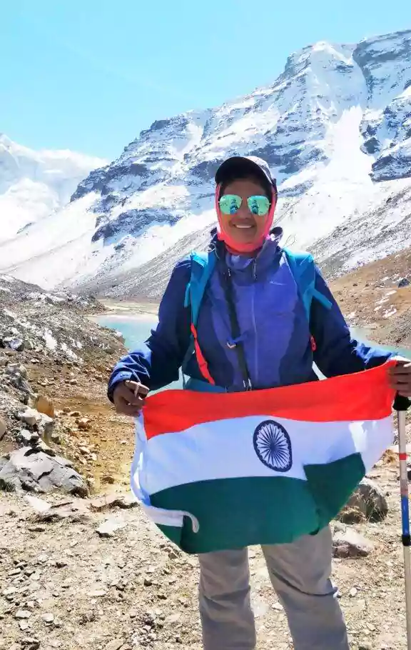
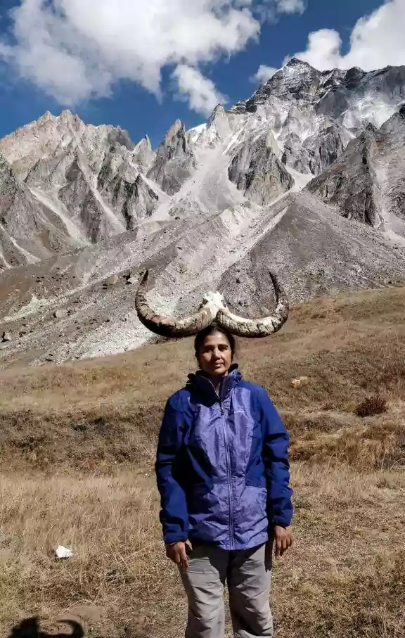
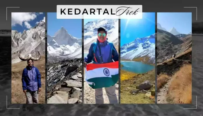
Kedartal Trek is one of the most beautiful and Challenging trek of Uttarakhand.
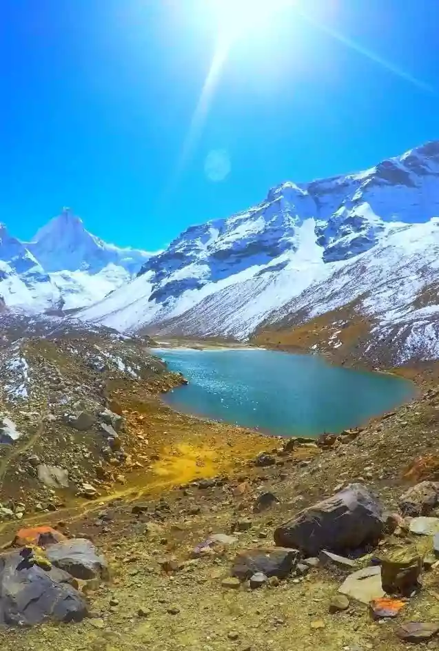
Kedartal is a high altitude glacial lake in the Garhwal region of Uttarakhand at an altitude of 16,116ft. this lake is fed by the Mt. Thalaysagar glacier and is the source of Kedar Ganga river.
According to mythology Lord Shiva takes bath in this emerald colored lake. One can see the majestic Mt.Bhrigupanth, Mt. Thalaysagar Mt.Jogin1 at its backdrop almost from their base.
Kedartal trek is a 7 day trek and its base camp is Gangotri (10,055ft).
It is a difficult trek because one gains approximately 16000 ft. altitude only in 3days which makes a trekker vulnerable to Acute Mountain Sickness(AMS).
Moreover this trek has a very challenging terrain where a trekker has to walk on scree zone, moraine, Boulder zone and glaciers.
Apart from this there are multiple rockfall zones and tricky spider walls that you must negotiate. And above all in case a trekker falls sick or is in pain, evacuation is next to impossible.
The sub-zero temperature also adds to the difficulty.

Table of Contents
Details of Kedartal Trek
Here are some of the important details that will help you to plan your trek. Below is the experience of Kedartal trek you must read and plan your trek accordingly. If you want any other information, Kindly visit Uttarakhand official tourism website.

- Altitude : 16116 Ft
- Base Camp : Gangotri
- Difficulty : Difficult
- Best Time : Sep – Oct
- Duration : 08 Days
My Experience with Kedartal Trek
Dada and I wanted to do a trek that would be more challenging than the ones that we have already done. From Indiahikes website we learned and Kedartal it was. The website says, Kedartal is a difficult trek and is not for everyone. So we decided to do the Kedartal trek in October 2019 and started our fitness preparation.
We were doing a combination of 5km run,10km walk with 6kg backpack, climbing up and down to 3rd floor 30 times at one go and lots of squats, lunges and burpees. We did not know at that point what we were getting into.
Itinerary of Kedartal Trek
Day 1 | Delhi to Dehradun | 280 KM
My husband was little worried when we were leaving home as he had heard that in last June one person died in Kedartal trek due to an avalanche and many trekkers had to be rescued by the army as the path was blocked due to the avalanche. But an adventure is all about taking calculated risk.
So I prayed to the weather God to be kind to us. In the mountains weather plays an important role for a trekker to successfully complete a trek. Dada and I started our journey to Dehradun by Shatabdi express and stayed there in a hotel.
Day 2 | Dehradun to Gangotri | 250 KM
On 13th morning all the 15 trekkers assembled near the Dehradun station. 12 trekkers were from different parts of India and there were 3 trekkers who had come from abroad..one girl from Slovenia and a couple from Switzerland.
Today we were to take a long journey to the base camp in Gangotri. We set off in 4 Sumo cars and reached Gangotri after 10hours. The drive was beautiful but tiring. Accommodation was in a hotel in Gangotri.
Here we met Gurkirat Singh alias Guru, our young and dashing trek leader. We were happy to see him as we had done our previous trek also under the leadership of Guru and he knew our strengths and weaknesses. Guru briefed all the trekkers and also checked their blood pressure and oxygen levels.
Some of the trekkers measured high blood pressure due to sudden altitude gain. But it was expected that the acclimatization would bring their blood pressure to normal level.
Day 3 | Acclimatization Day |
Today was our acclimatization day. So in the morning after breakfast we went on one of the trek routes and climbed 950ft and returned to the the base camp before lunch. Post lunch after resting for sometime Dada and I went to Gangotri Temple and also roamed around the pilgrim town.
After an early dinner we went to bed as the next day’s trek would be a tough one.
Day 4 | Gangotri (10,055ft) to Bhojkharak (13,300ft), 9 KM, 06 hrs. and 30 min |
Today’s trek was relentless steep climb all the way to Bhojkharak. We ascended approximately 3,300ft. We also had to negotiate the infamous spider wall 1 and spider wall 2. Spider wall 1 is a rock face where we had to crawl under a ledge to reach the other side.
Spider wall 2 is a near vertical rock wall with a very narrow path. It’s seems dangerous as the Kedar Ganga river is turbulently flowing 100m below and if anyone loses balance he/she would fall in the river and it would definitely be fatal.
But I felt if one doesn’t look down this patch is not so difficult to cross. Anyways after about 6.30hours of climb we reached Bhojkharak campsite. This place was a narrow valley with hardly any flat surface to pitch tents.
But it seemed because of availability of water source, tents were pitched here. Most of the tents had uneven surface but we were so exhausted that we didn’t care and slept like babies.
Day 5 | Bhojkharak (13,300ft) to Kedarkharak (14,238ft), 4.25km, 05 hours |


Next day we got up early. It was very cold. After having breakfast we set out for our next part of the adventure. We had to cross a few dangerous Rock fall zones that day and we wore our helmets provided by India hikes.
After walking for only 500m from the campsite we reached the most challenging part of the trek…the Rockfall Zone. We saw a large part of the mountain slope in front of us was barren with exposed rocks, stones and loose soil. There was an almost non-existent path on loose soil which had to be traversed and Kedarganga was raging past only about 50ft below.
I could see small rocks and loose mud tumbling down in intervals. One of the guides Digambar ji went ahead and positioned himself on a rock near the river from where he could get a clearer view of the Rockfall slope.
Then we were asked by our trek leader Gurkirat Singh to cross one at a time keeping our focus on Digambar ji and move or stop when he signals. With God’s grace and the expertise of the trek leader and guides, all of us crossed this area without any untoward incident.
Bonus Read – Planning for Treks do read our other blogs on Adventures Category.
After this we crossed few more patches of loose rocks and the loose soil on which we walked, was so unstable that we had to put forward the successive step faster before the preceding step slid down along with the loose soil. We were mentally tired due to the stress and fear of falling into the river and our legs also became wobbly.
Anyways, after some more ascent we finally reached Kedarkharak (14,238ft).
Kedarkharak was fascinating…
It was a vast valley with dry grass of multiple hue, beside a beautiful stream. The valley was surrounded by mountains of different shapes and colour and snow capped Bhrigupanth and Thalaysagar right in front. Though we were tired but we were energized by this sight.
That day by evening, due to the altitude gain, some of us started showing mild symptoms of AMS. For me the symptom was complete loss of appetite whereas some of us had headache and feeling of nausea.
That evening my oxygen level read 78 in the oximeter which was quite low and Guru made me drink lots of water.
After an early dinner(I couldn’t eat anything) we all retired inside our sleeping bags as it had become extremely cold. During the night the temperature dipped to as low as minus 7°C.
I shivered through out the night and kept on drinking water. I was praying that by morning my blood oxygen level should increase else I might be asked not to attempt the final leg to Kedartal as it involved another 1800ft attitude gain.


Day 6 | Kedarkharak (14,238ft) to Kedartal (16,116ft) and back to Kedarkharak | 5.5km, 06hrs |
We woke up to a freezing morning to find water had frozen in the drum. We decided to wash our face and brush our teeth after returning from Kedartal. The kitchen staff managed to give us hot water to drink and carry for the trek. My Oxygen level had improved so we got ready for the final push.
Today’s trail was continuous ascent over a rocky terrain which was actually a glacier with moraine, scree and big boulders. I was feeling very weak as I hadn’t had dinner and breakfast due to appetite loss. The water mixed with ORS kept me going though I was lagging behind others.
Dada was walking slowly to be with me and kept motivating me. We crossed so many ridges one after the other and finally reached Kedartal. It was a sight to behold. The crystal clear emerald lake was in front of us with the reflection of majestic Mt. Bhrigupanth, Mt. Thalaysagar and Jogin peak in it. A divine sight…we were spellbound.
We all felt it was worth taking all the pain and risk to witness this enchanting beauty. After soaking in the beauty for sometime we started our descent to return to Kedarkharak. We reached Kedarkharak by evening.
Day 7 | Kedarkharak to Gangotri via Bhojkharak |
Next morning, it was an early morning trek to go down to Gangotri without taking any night halt at Bhojkharak. Now it seemed that the descent was more difficult than the ascent. Our knees were in pain due to the continuous descent, But as they say “going up the mountain is optional but coming down is mandatory”.
Therefore we had to keep on walking. One by one we also crossed those difficult sections of landslide zone, spider wall 1 and 2 and finally after a 9 hours walk we reached Gangotri. We all were happy to have completed such a difficult trek and we felt a sense of achievement.
Day 8 | Gangotri to Dehradun |
We took 10 hour journey back to Dehradun by 04 sumo cars and travelled back to Delhi by train, We returned home with amazing memories and the confidence that we can attempt more difficult treks in future.
Frequently Asked Questions
What is the best time for Kedartal Trek?
The Best time considered for the Kedartal Trek is September and October.
What will be the duration of the Kedartal Trek?
The Duration is of minimum 07 to 08 Days and this trek requires good amount of Fitness.
Joshi Milestoner is a website working continuously to deliver the best on travel, adventure and airports & aviation. Do not forget to read our blogs and for any queries you can write to us our team will be happy to help you.
Get notified of our blog post via email by subscribing to our Newsletter with the link provided below and do consider subscribing our YouTube channel (Joshi Milestoner) too for more you can follow us on Google News.

Affiliate Disclosure / Disclaimer: Blog Post on our website may contain affiliate links/ Banner. By Clicking and by purchasing the commission can be earned by us (at no extra cost to you) if you purchase anything through the links provided on this website.


While trekking down ur blog , all there is a smile on my face 🙃🙂🙂🙂🙂
Keep up the good work. Always proud of you
Very Informative & detailed and yet expressed succinctly.
Paints a very vivid picture of the beauty of this trek on my mind.